Civitates
Towns
A settlement in each style, laid out by its tradition’s rules of planning. Walk the streets and click a building to see which rules it follows.
Ancient
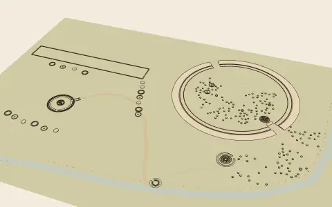 Prehistoric and Megalithic · 9500–1500 BC
Durrington Walls and Stonehenge
The Stonehenge landscape, c. 2500 BC, with distances shortened
The largest settlement of Neolithic Britain, inside the chalk ring of Durrington Walls, with its timber circles and avenue to the river Avon; and, down the river, the stone circle of Stonehenge with its own avenue: the land of the living and the land of the dead.
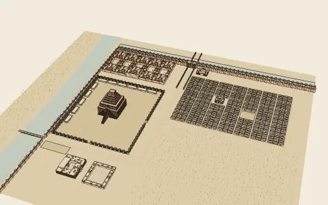 Mesopotamian · 3500–539 BC
Babylon
The inner city of Nebuchadnezzar II, c. 575 BC
The heart of Babylon as Nebuchadnezzar rebuilt it and Herodotus described it: the double wall and moat, the Ishtar Gate of glazed brick, the Processional Way past the palace to the temple tower Etemenanki and the temple of Marduk, and courtyard houses on straight streets running to the river.
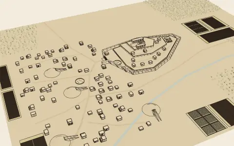 Aegean Bronze Age · 3000–1100 BC
Mycenae
The citadel and lower town, c. 1250 BC
The fortified hill of the Mycenaean kings: a circuit of Cyclopean walls entered by the Lion Gate, the grave circle of the ancestors inside it, the palace megaron on the summit, and outside the walls a straggling lower town and the great tholos tombs beside the roads.
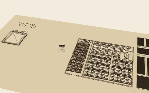 Ancient Egyptian · 2700–30 BC
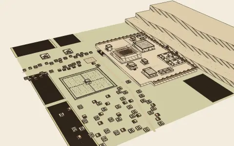
Kahun, a pyramid town
The town of Senusret II at Illahun, c. 1890 BC
A walled town of about 13 hectares built in one campaign for the priests, officials and workmen of Senusret II’s pyramid: a grid of streets, a walled quarter of standard small houses, a row of great houses with north-facing porticoes and granaries, and the pyramid itself across the desert edge.
 Achaemenid Persian · 550–330 BC
Persepolis
The terrace of Darius and Xerxes, c. 480 BC
The ceremonial capital of the Achaemenid kings: a walled terrace against the Mountain of Mercy, climbed by a double stair, carrying the Apadana, the Hundred-Column Hall and the palaces (every one a square hall of columns) above a town and a walled paradise on the plain.
The Americas
 Andean · 3000 BC – 1572
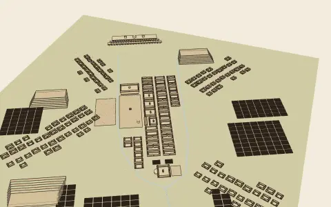
Cuzco, the Inca capital
The city about 1530, after Garcilaso de la Vega
The navel of the Inca world on the eve of the conquest: the great square with its ushnu, the palaces of the dead kings round it, walled kancha compounds packed between two canalised rivers, the Temple of the Sun at their meeting, the four royal roads leaving for the four quarters of the empire, and the fortress on the hill above.
 Mesoamerican · 1200 BC – 1521
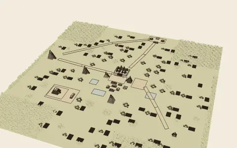
Tikal, a Classic Maya city
The ceremonial centre about AD 750, after the buildings and Landa
The heart of Tikal in its eighth-century prime: two temple-pyramids facing each other across the Great Plaza, the acropolis of the royal dead to the north and the palace ranges to the south, white causeways running out to the other great temples, and patio groups of thatched houses graded outward from the centre.
East Asia
 Chinese · 1600 BC – 1912
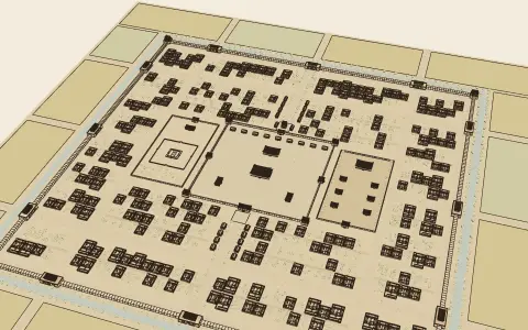
The royal city of the Kaogong ji
After the Kaogong ji, with halls of the Yingzao fashi and lanes of Yuan Dadu
The ideal capital of the Record of Trades, reduced four times in plan: a walled square with three gates a side and nine roads each way, the palace at the centre facing south, the ancestral temple on its left, the altar of soil and grain on its right, the court in front and the market behind, the whole filled with courtyard houses along east–west lanes.
 Korean · AD 372 – 1910
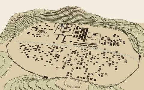
Hanyang, the Joseon capital
After the Annals of the Joseon Dynasty and the Kaogong ji
Seoul as the founders of Joseon laid it out between 1394 and 1414: a basin closed by four guardian mountains with the wall on their ridges, Gyeongbokgung under Bugaksan facing south, Jongmyo on its left and Sajikdan on its right, the ministries before the palace gate, the market along Jongno, and tiled and thatched houses sized by the owner’s rank.
 Japanese · AD 588 – 1868
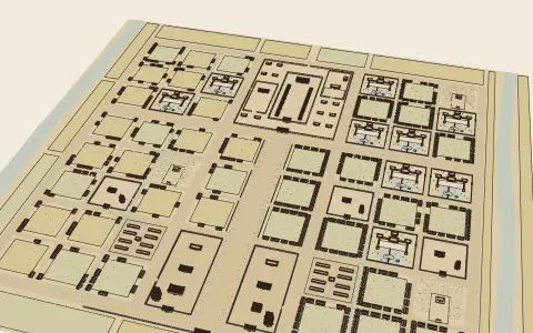
Heian-kyō, the capital of peace
After the Engishiki, the Sakuteiki and the Shōmei
The Heian capital (Kyoto) of the tenth century, reduced to one ward on each side of Suzaku-ōji: blocks of forty jō and avenues of true width, the palace at the north, the Rashōmon at the south with the two state temples beside it, the East and West Markets, nobles’ shinden estates and commoners’ row houses.
Classical
 Ancient Greek · 700–31 BC
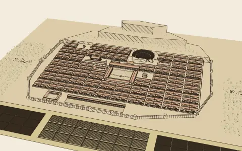
Priene, a Hippodamian city
After Aristotle, Politics II.8 and VII.11–12, and Vitruvius, Book V
A small Greek city laid out on a Hippodamian grid of equal blocks down a steep hillside: the agora ringed by stoas at its centre, the temple of Athena on a terrace above, the theatre cut into the slope, the council house beside the agora, and some two hundred courtyard houses turned to the sun.
 Ancient Roman · 300 BC – AD 476
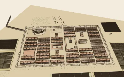
A Roman colony
After Vitruvius, Books I and V
A walled colonia of about 16 hectares, laid out on a grid of insulae around the crossing of the cardo and decumanus, with every public building placed and proportioned as Vitruvius directs.
South & Southeast Asia
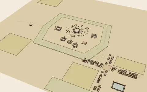 Buddhist India · 270 BC – 1200
Sanchi, a monastery on its hill
The monastic hill about AD 600, after the Vinaya and the Great Passing
The Buddhist establishment on the hill of Sanchi at its height: the Great Stupa with its four gateways at the centre of a paved terrace, Ashoka’s pillar at its south gate, lesser stupas and the shrines of the Gupta age round it, square monasteries of cells on the terraces, and below, the village that fed the monks.
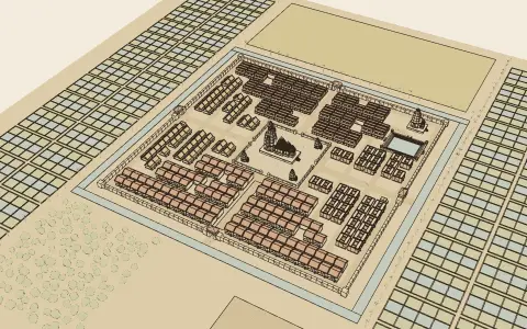 Hindu Temple: Nagara (North Indian) · AD 450 – 1300
A village of the Mānasāra
A sarvatobhadra village laid out on the 81-square diagram
A square walled village “auspicious on every side”, laid out on the eighty-one-square Vāstupuruṣa diagram: the temple on the central squares of Brahmā facing east, ring streets between the zones of gods, men and spirits, four gates on the axes, Śiva and the tank in the north-east, and houses of each varṇa in its own quarter, sized by rank.
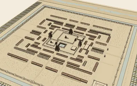 Hindu Temple: Dravida (South Indian) · AD 600 – 1750
Madurai, the temple city
The Nayaka city about 1650, after the Mayamata
The city of the goddess Meenakshi under the Nayaka kings: the double temple at the centre inside concentric walls, four towering gopuras on the axes, square rings of streets named for the festival months with the temple cars drawn round the outermost, rows of houses between them, and the fort wall of seventy-two bastions round all.
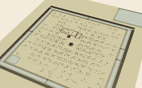 Khmer · AD 802 – 1431
Angkor Thom, the Khmer capital
The walled city as Zhou Daguan saw it in 1296
The last and greatest capital of Angkor: a square of three kilometres inside a laterite wall and a moat a hundred metres wide, five gates crowned with faces and reached by causeways lined with giants, avenues running to the Bayon at the exact centre, the Baphuon and the palace to the north, and a grid of embankments and ponds among which the people lived in houses on stilts.
Medieval
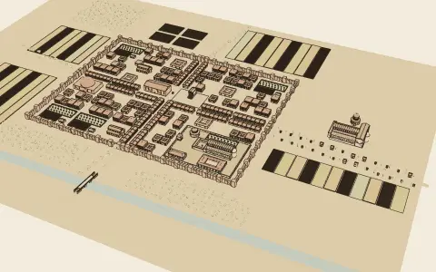 Early Christian · AD 313 – AD 600
A late-antique bishop’s city
After the Apostolic Constitutions, Eusebius and the Theodosian Code
A walled Roman city of the fifth century as the Church was reshaping it: the old grid, forum and baths still standing, a cathedral with its baptistery and bishop’s house in a precinct by the wall, and a great martyr’s basilica in the cemetery outside the gate.
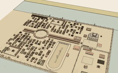 Byzantine · AD 330 – 1453
Constantinople: the Mese and the Great Church
After Zeno’s building law, Procopius, Julian of Ascalon and the Book of the Eparch
The heart of the Byzantine capital around the year 1000: Hagia Sophia and the Augustaion, the walled Great Palace entered by the Chalke, the Hippodrome, and the Mese running west between its porticoes to the round Forum of Constantine, with courtyard houses, monasteries and parish churches behind.
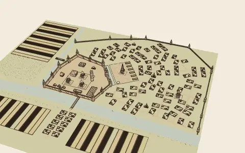 Russian · AD 988 – 1700
A Muscovite kremlin and its posad
After Herberstein, Olearius and the Moscow chronicles, c. 1500–1650
A Russian town of the sixteenth and seventeenth centuries on the Moscow pattern: a brick kremlin on the promontory where two rivers meet, holding the cathedrals, the bell tower and the palace; a cleared market square before its landward gate; and a wooden posad of log houses in fenced yards, ringed by a palisade.
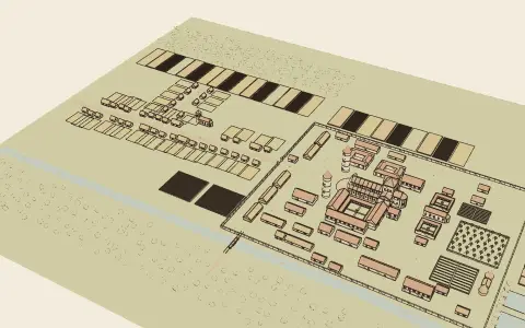 Romanesque · 1000 – 1200
A Benedictine abbey on the Plan of St Gall
After the Rule of St Benedict and the Plan of St Gall (c. 820–830)
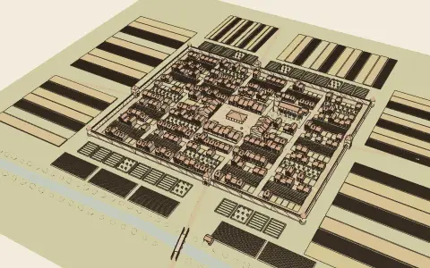
A great Carolingian monastery built as the Plan of St Gall draws it (church in the middle, cloister to the south, guests and school to the north, novices and sick to the east, workshops, mill and farm to the south and west), with its village outside the gate.
 Gothic · 1140 – 1530
A bastide in Gascony
After the charters of paréage and customs, c. 1250–1320
A planned new town of the thirteenth century in south-western France, on the model of Monpazier: a rectangle of straight streets, equal house plots, an arcaded market square with its hall at the centre, the parish church on a block at its corner, and a wall with gates where the streets leave the town.
Islamic
 Early Islamic (Umayyad and Abbasid) · AD 622 – 1050
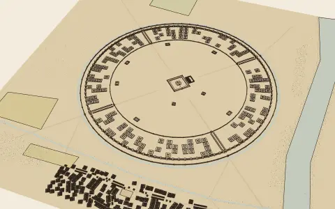
Baghdad, the Round City
Madinat al-Salam of al-Mansur, 762–766, after al-Ya‘qubi and al-Khatib al-Baghdadi
The caliph’s city as a perfect circle about 2.3 km across: moat, double wall and four gates on the diagonals, a ring of houses in named streets, and at the centre an empty court with only the palace of the Green Dome and the Friday mosque. The markets lie outside, in al-Karkh.
 Moorish (Western Islamic) · AD 756 – 1492
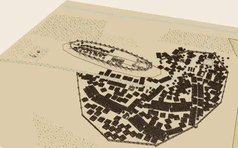
Granada under the Nasrids
The last Muslim capital of al-Andalus, c. 1450, by the law of the neighbours and the rules of the market
A walled medina between two hills: the Great Mosque with its silk market, college and funduq in the lower city, the Albaicín on its hill across the Darro, and the Alhambra on the Sabika ridge above. Between them a dense fabric of patio houses on through-streets and dead-end lanes.
 Persian Islamic (Seljuk, Timurid and Safavid) · 1000 – 1722
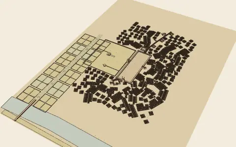
Isfahan: the Maidan and the Chahar Bagh
The capital of Shah Abbas I and his successors, c. 1670, as Chardin saw it
A new royal centre laid beside the old city: the Maidan, 510 by 160 metres, ringed by arcades, with the Shah’s mosque, the palace gate, the court mosque and the bazaar gate on its four sides; the covered bazaar running north; the palace gardens and the Chahar Bagh avenue running south to the river.
 Ottoman · 1300 – 1922
The Süleymaniye quarter, Istanbul
Sinan’s külliye for Süleyman the Magnificent, 1550–57, and the timber quarters round it, c. 1580
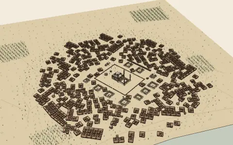
On the third hill of Istanbul above the Golden Horn, a sultan’s mosque in its walled court, with the founder’s tomb behind and its dependencies round it (four colleges, schools of medicine and tradition, a hospital, a kitchen, a guest-house, a caravanserai, a bath and shops), all one charitable foundation. Round it, neighbourhoods of timber houses, each with its small mosque.
 Mughal · 1526 – 1857
Shahjahanabad (Old Delhi)
Shah Jahan’s capital, founded 1639, as François Bernier described it c. 1660
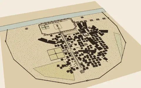
A walled city bent round a fortress-palace on the Yamuna: from the fort’s gates two broad streets with canals down their middle, Chandni Chowk running west to the Fatehpuri mosque and the Faiz Bazaar south; the Friday mosque raised on its rock between them; havelis and lanes behind the arcades.
Renaissance & Baroque
 Renaissance · 1420 – 1600
Sforzinda, an ideal city
After Filarete’s treatise (c. 1461–64) and Alberti’s De re aedificatoria
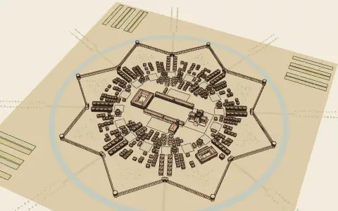
The first fully planned ideal city of the Renaissance: an eight-pointed star of walls inside a round moat, sixteen straight streets from a central piazza, the cathedral and the prince’s palace facing each other across the square, and a ring of parish and market squares.
 Mannerism · 1520 – 1600
A fortress town of nine bastions
On the plan of Palmanova (1593), after Scamozzi and Serlio
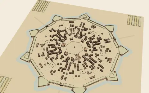
A Venetian frontier fortress built as a single geometric figure: a nine-sided bastioned trace round a hexagonal parade ground, radial streets and ring roads, three rusticated gates, palaces near the centre and humbler houses toward the walls.
 Palladian · 1540 – 1800
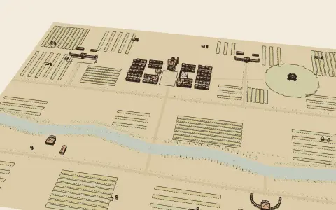
Villas on the Brenta
After Palladio’s Quattro libri (1570), Books II and III
A stretch of the Venetian mainland as Palladio’s treatise orders it: villas set by the river and in the middle of their fields, each a temple-fronted house joined to its farm by barchesse; roads raised and lined with trees; and a small town whose piazza gathers the basilica, the loggia of the governor and the church.
 Baroque · 1600 – 1750
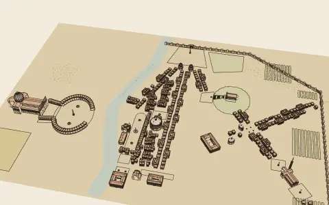
Rome of the popes
Sixtus V’s streets and obelisks (Fontana, 1590) and Bernini’s piazza
A composite of Baroque Rome: the trident from Piazza del Popolo, the straight Strada Felice from Trinità dei Monti to Santa Maria Maggiore, the Quattro Fontane on the Strada Pia, obelisks at the ends of the streets, and across the Tiber the oval piazza of St Peter’s.
 Rococo · 1720 – 1780
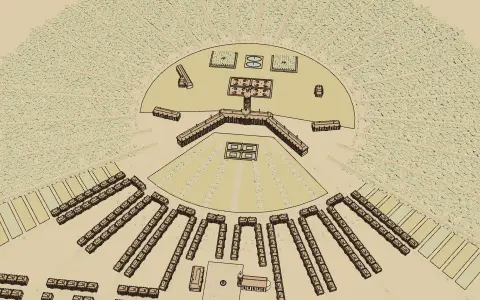
A residenz town on a fan plan
After Karlsruhe (1715), with the gardens of Dezallier and Blondel
A prince’s new town cut out of a forest: thirty-two straight rays from the palace tower, nine of them streets fanning south between the palace wings to a long cross street, twenty-three of them rides through the woods; uniform houses under mansard roofs, parterres and pavilions behind the palace.
Revival & Industry
 Gothic Revival · 1740 – 1900
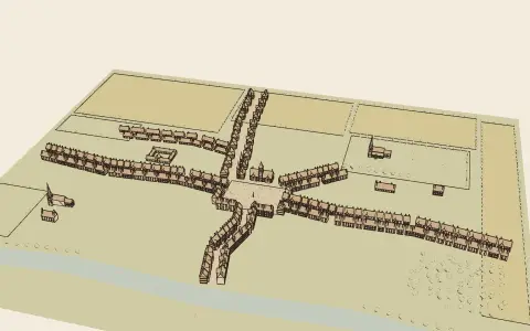
A Victorian Gothic parish
After Pugin’s Contrasts and True Principles and the Ecclesiologists, c. 1865
An English market town rebuilt by the rules of the Gothic Revival: orientated churches whose spires make the skyline, a Ruskinian town hall with its clock tower over the market cross, a parish school and parsonage by the churchyard, almshouses round a court, and streets of steep-roofed brick houses.
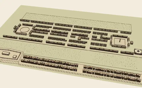 Neoclassical · 1750 – 1850
Edinburgh’s New Town
After James Craig’s plan of 1767 and Laugier’s Essai, c. 1830
The first New Town of Edinburgh as it stood around 1830: a grid of three parallel streets on a ridge between two squares, the outer streets built on one side only to look over gardens, every long view closed by a public building, and one square given a single palace front.
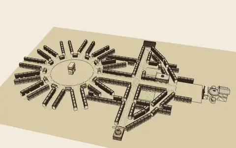 Beaux-Arts · 1830 – 1930
Haussmann’s Paris
After the decrees of 1852 and 1859 and Haussmann’s Mémoires, c. 1875
A quarter of Second Empire Paris composed from its parts: the Étoile with its twelve avenues and uniform hôtels, a planted avenue driven to the Opéra, a boulevard running from a railway station to a domed church, and every street walled by stone immeubles whose cornices stop at the height the 1859 decree allows.
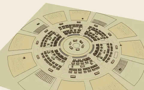 Arts and Crafts · 1860 – 1915
A garden city
After Ebenezer Howard’s Garden Cities of To-morrow (1902) and Raymond Unwin’s cottages
Howard’s diagram built: a circular town in six wards round a central garden, with its public buildings, Central Park, glass arcade, Grand Avenue of schools and churches, rings of Arts and Crafts cottages at twelve to the acre, a factory ring on the circular railway and a permanent agricultural belt.
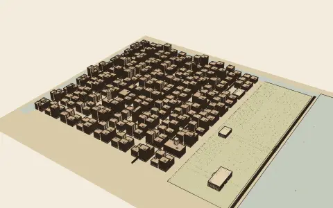 Chicago School · 1880 – 1910
The Chicago Loop
After Sullivan’s Tall Office Building (1896), the height ordinances and Burnham’s Plan of Chicago (1909)
The business district of Chicago around 1905: a grid of blocks packed with steel-framed offices in base, shaft and top, built out to the lot lines and up to the height limit, ringed by the elevated Union Loop, with the lakefront park and the Plan of 1909’s axis along Congress Street.
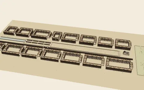 Art Nouveau · 1890 – 1914
The Wienzeile, Vienna
After Otto Wagner’s Moderne Architektur (1896) and his plans for the Wien valley, c. 1905
Vienna’s Wien valley around 1905: the regulated river vaulted over to carry the Naschmarkt, the Stadtbahn in its cutting with Wagner’s stations, Olbrich’s Secession at the head of the market, and Wagner’s Majolikahaus in a street of uniform apartment houses.
Modern & Contemporary
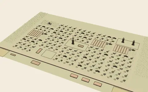 Organic architecture · 1900 – today
Broadacre City
After Frank Lloyd Wright’s The Disappearing City (1932) and his model of 1935
A section of Wright’s decentralised city: Usonian houses each on its own acre, little farms and orchards, a roadside market and small factories on the arterial highway with its monorail, and a single tower standing alone as the county seat.
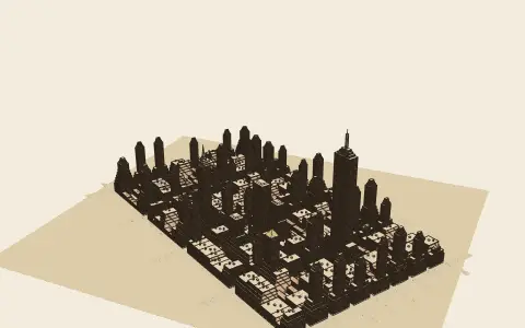 Art Deco · 1920 – 1940
A Manhattan setback district
After the 1811 grid and the 1916 Zoning Resolution, c. 1931
Thirty-two blocks of a midtown district on the 1811 grid, in which every building fills, or stays below, the envelope set by the 1916 zoning law: street walls twice the street width, tiers behind the sky-exposure plane, and towers on a quarter of the lot.
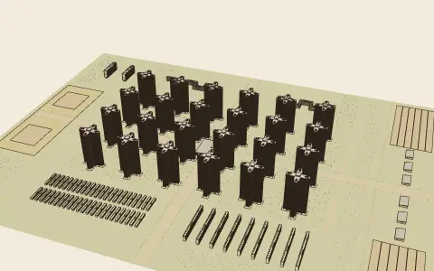 Modernism · 1920 – 1970
The functional city
After Le Corbusier’s Ville Contemporaine (1922) and the Athens Charter (1933)
A city of the modern movement built from its manifestos: twenty-four cruciform towers in a park round a central station, housing in slabs à redents, Unités and Zeilenbau rows, industry beyond a green belt, and motorways that never become streets.
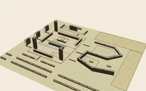 Brutalism · 1950 – 1980
A brutalist estate
After the Barbican and Golden Lane, London, and Park Hill, Sheffield
Two kinds of post-war estate side by side: a Barbican-type precinct of towers and terrace blocks on a podium, with a lake, an arts centre and highwalks over the roads; and a Park Hill-type slab snaking across its site, with a street deck every third floor.
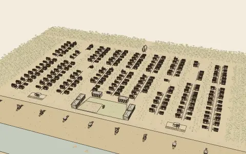 Postmodernism · 1965 – 1995
Seaside
After the Seaside code (Duany Plater-Zyberk, 1980) and the Charter of the New Urbanism
A small resort town on the Gulf of Mexico built to a one-page code: cottages with porches and picket fences on streets running to the sea, arcaded buildings on a central square, a temple-fronted post office, and a pavilion closing the end of every street.
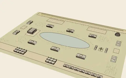 High-Tech · 1967 – today
A high-tech business park
After Stockley Park and the sheds of Foster, Rogers and Hopkins, 1980s
A landscaped business park by a motorway: glass office pavilions round a lake, a headquarters with its services outside, laboratories round a tensile winter garden, masted sheds and plug-in units on a permanent grid of roads and services.
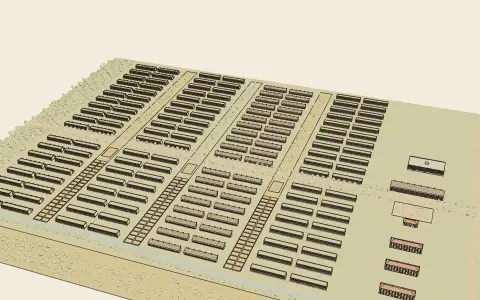 Sustainable architecture · 1970 – today
A solar eco-district
After Vauban, Freiburg (1998–2006), and BedZED, London (2000–02)
A car-free district of south-facing terraces in east–west rows, each row spaced from the one in front by the midwinter sun, with green spines, a tram on a grass track, a solar garage at the edge, and BedZED-type terraces with sunspaces, green roofs and wind cowls.
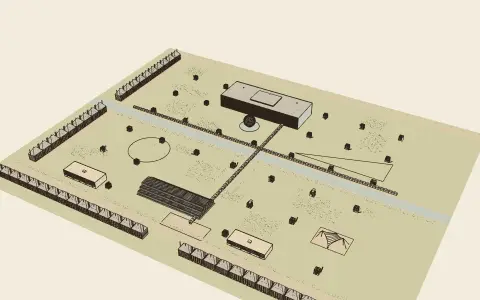 Deconstructivism · 1982 – 2005
The Parc de la Villette
After Bernard Tschumi’s competition design (1982–83), Paris
An urban park made of three superimposed systems: red folies on a 120-metre grid (points), two covered galleries and a winding promenade (lines), and great lawns (surfaces), laid over a site that keeps its canal, its iron market hall and its new museums.
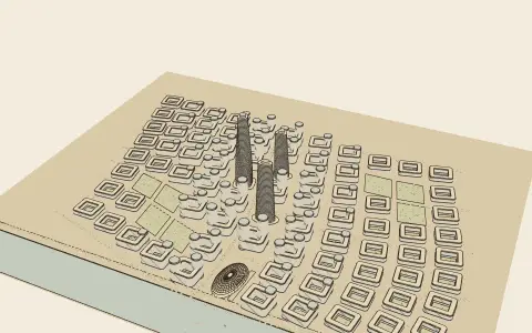 Parametricism · 2000 – today
A parametric urban field
After Zaha Hadid Architects’ Kartal-Pendik masterplan, Istanbul (2006)
A new urban centre on a soft grid: streets bent to meet the lines of their surroundings, blocks that morph by degrees from courtyards to towers as a height field rises towards the central spine, twisting towers at its peaks and a landform shell on the waterfront.
46 of 60 styles have a town so far.